
Why Homeowners May Need an Elevation Certificate Before Applying for FEMA Flood Assistance
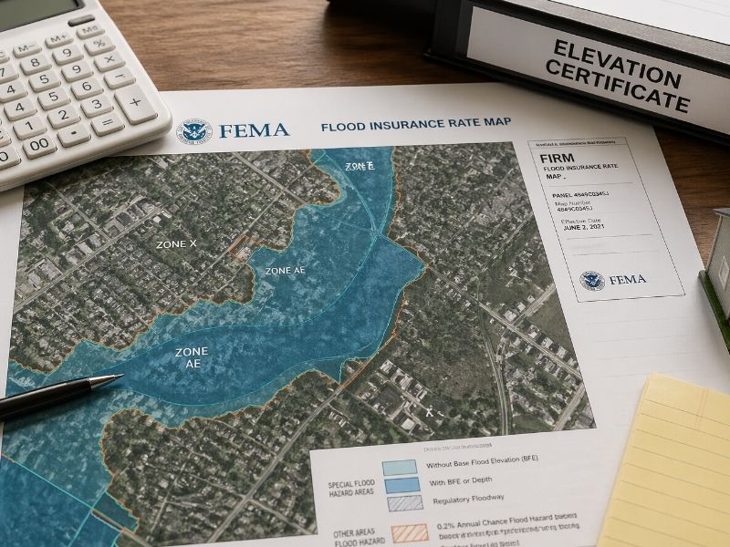
What Is an Elevation Certificate?
An elevation certificate is a document that shows how high a home sits compared to the flood level nearby.
A licensed surveyor usually prepares the document. It includes elevation measurements, flood zone details, building information, and photos of the structure. Insurance companies, lenders, and FEMA programs may ask for it during flood-related reviews or applications.
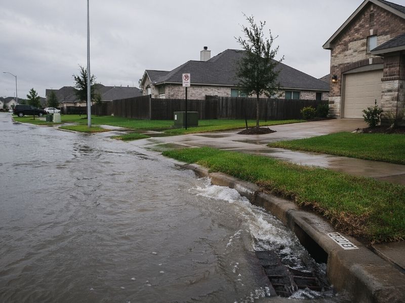
Heavy rain can create serious problems for homeowners. One storm may leave standing water in the yard. Another may bring floodwater close to the home. After that, many property owners start looking into flood insurance, FEMA flood help, or ways to lower future flood risk.
That is often when the elevation certificate becomes important.
Many homeowners do not hear about this document until someone requests it. An insurance company may ask for one during a flood insurance review. A lender may need it before approving certain paperwork. Some FEMA-related programs may also require elevation information before applications can move forward.
Without accurate elevation data, flood-related decisions become harder to make.
Why Elevation Information Matters
How Elevation Can Affect Flood Insurance
Flood insurance companies use elevation data to help measure flood risk.
If the lowest floor of a home sits below the expected flood level, insurance costs may increase. If the structure sits higher, homeowners may qualify for lower flood insurance rates.
Even a small height difference can matter.
Two homes on the same street may have very different flood risks because one sits slightly higher than the other. That difference may not look important from the road, but it can affect insurance costs and flood-related decisions.
This is why elevation certificates matter.
The document provides real measurements instead of estimates. Insurance companies want numbers they can verify. FEMA programs also review elevation data during certain flood-related requests.
Without that information, homeowners may struggle to show how their property compares to the flood level in the area.
Some Homeowners Learn About It Too Late
Flood Problems Can Happen Almost Anywhere
Many people think flood insurance only matters near rivers or coastal areas. That idea creates problems every year.
Flooding can happen in many locations. Poor drainage, low ground, blocked storm drains, and heavy rain can all cause flood problems.
Some homeowners first hear about elevation certificates after receiving a flood insurance quote that feels very expensive. Others discover the issue during a home sale, refinance, or repair project.
That can delay everything.
Surveyors need time to visit the property, collect measurements, and prepare the document correctly. During storm season, requests often increase quickly. Waiting too long can lead to extra stress and longer wait times.
What an Elevation Certificate Includes
Information Found on the Document
Many homeowners expect a short form with basic details. The actual document contains several pieces of information tied to FEMA flood rules.
An elevation certificate often includes:
- The flood zone for the property
- The elevation of the lowest floor
- Flood elevation data nearby
- Building details
- Surveyor measurements
- Photos of the structure
These measurements help show flood risk. Even small elevation differences can affect flood insurance costs and other flood-related decisions.
Because of that, accurate measurements matter.
Old records sometimes contain mistakes or outdated information. That can create problems later during insurance reviews or property transactions.
FEMA Flood Assistance May Require Property Information
Flood assistance programs often require property information before applications can move forward. The exact rules may change depending on the situation, but elevation data often becomes part of the process.
Homeowners may need elevation information when:
- Applying for certain FEMA flood programs
- Repairing flood-damaged structures
- Raising a home above flood level
- Requesting flood insurance changes
- Challenging flood zone information
A missing elevation certificate can slow paperwork down. It can also leave homeowners confused about what steps come next.
After flood damage, most people want quick answers. Instead, they often deal with maps, measurements, and paperwork requirements.
Older Homes Often Need Updated Information
Why Older Properties Create More Questions
Some newer homes already have elevation records attached to the property file. Older homes often do not.
That can create problems during flood insurance reviews or FEMA-related applications.
Some older homes were built before current flood map rules existed. Others changed over time through renovations, additions, or grading work. Drainage around the property may also look very different compared to years ago.
Because of that, older homes often need updated elevation information.
Some homeowners also learn that past owners lost the paperwork or never ordered an elevation certificate at all.
Surveyors Help Homeowners Through the Process
Why Accurate Measurements Matter
Elevation certificates require real property measurements. Licensed surveyors use professional equipment to gather the information.
The process usually starts with a property visit. The surveyor checks the structure, takes measurements, reviews flood maps, and records the details needed for the certificate.
After that, the information goes into FEMA-approved documents.
Accurate numbers matter. Even small mistakes can affect flood insurance costs or future property sales.
Good surveyors also explain the results clearly. Homeowners should understand what the measurements mean without feeling confused by technical terms.
Why Homeowners Should Prepare Early
Waiting Too Long Can Create Delays
Flood problems rarely happen at a convenient time.
Strong storms can increase survey requests very quickly. Insurance questions also rise after heavy rain or flood warnings. That can create longer wait times for inspections and paperwork.
Getting elevation information early gives homeowners more time to prepare. It also helps avoid rushed decisions during stressful situations.
An elevation certificate may look like just another document at first. Still, it can affect flood insurance costs, FEMA flood assistance, repair projects, and future property sales.
Homeowners who wait until flooding starts often face tighter deadlines and more confusion. Getting the certificate early gives a better understanding of the property and helps avoid delays later.
For homes near flood-prone areas or places with drainage problems, accurate elevation information can save time, reduce stress, and help homeowners make better decisions in the future.
Flood recovery already comes with enough stress. Having the right property information before problems happen can make the process much easier. An elevation certificate helps homeowners understand their flood risk, prepare for insurance questions, and avoid delays when flood-related paperwork becomes urgent. For many property owners, getting the document early is a simple step that can prevent bigger problems later on.