
Can LiDAR Mapping Improve Planning Around Active Railroad Corridors?
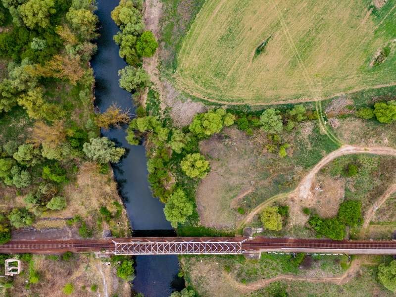
Planning near a live rail line is one of the trickiest jobs a developer can take on. Trains keep running while you need data, and nobody gets to stand on the tracks to gather it. LiDAR mapping offers a way to collect detailed ground and corridor data without putting a crew in harm’s way. For projects near the busy rail lines around Pensacola, that safer path to good data can decide whether a plan moves forward or stalls. Get the survey approach right early, and the rest of the design work rests on solid ground.
What Makes Active Railroad Corridors Difficult to Survey
Rail corridors carry rules that most sites do not. The track and the strip beside it belong to the railroad, and access is tightly controlled. A crew often needs permits, escorts, and scheduled work windows just to step near the line. That paperwork alone can push a survey back by weeks before a single point gets collected.
Safety drives every decision out there. Trains move fast and quietly, and a field crew has little room to react. Working close to live track means constant watch, radio contact, and hard limits on where anyone can stand. Many railroads also require a flagger on site, which adds cost and coordination. The risk is real, so the rules are strict.
Then there is the problem of sight lines. Embankments, brush, and passing trains block the view a traditional survey needs. A crew may wait through several trains just to shoot a handful of points. Along a corridor that runs for miles, that slow pace adds up fast. A job that would take a day on open ground can stretch across a week beside active track.
How LiDAR Mapping Captures Terrain and Corridor Features
LiDAR mapping fires laser pulses at the ground and times how long each one takes to return. Millions of those returns build a dense point cloud of the surface. The sensor can ride on a plane, a drone, or a vehicle, which keeps the crew off the track. That standoff distance is a big part of the appeal near rail.
The survey data it captures is rich. A single flight can record the track, the embankment, drainage ditches, vegetation, and nearby structures all at once. Each point carries an exact position and elevation. You end up with a full picture of the corridor and the ground around it, not just a few measured spots. The sensor does not care how many trains pass while it works.
Features LiDAR mapping can record along a corridor
- Track alignment and top-of-rail elevations
- Embankment slopes and ditch profiles
- Drainage paths and low points near the line
- Vegetation height and encroaching brush
- Bridges, culverts, signals, and other structures
- Ground surface across the surrounding parcels
That breadth lets a design team work from one consistent dataset. They see how the corridor sits within the wider site. Fewer return trips are needed to fill gaps, which keeps both cost and crew exposure down. One good capture can serve several teams at once.
Where LiDAR Data Supports Railroad Planning Decisions
Grading is often the first use. A dense terrain model shows how water and earth move across a site next to the tracks. Planners can test cut and fill options on the computer before anyone touches the ground. They can compare two or three grading schemes in an afternoon. That saves money and rework.
Drainage planning relies on the same data. Rail embankments change how runoff flows, and a small blockage can contribute to drainage problems on nearby properties. LiDAR mapping reveals the low points and flow paths that matter.
Access and clearance checks round out the list. A point cloud lets a team measure the distance from a proposed road, utility, or building to the track. They can confirm sight lines and vertical clearances at a bridge or crossing. When a plan needs railroad approval, that measured evidence helps make the case. Reviewers trust numbers pulled from real data more than rough field estimates.
Limits of LiDAR Around Rail Infrastructure
LiDAR mapping is powerful, but it is not magic. Thick vegetation can hide the true ground surface, since the laser may only reach the top of the brush. Skilled processing pulls out ground points, yet dense cover still weakens the result. Some areas will need a crew on foot to confirm elevations, and that means the same access rules apply again.
Certain surfaces fight back too. Shiny rail, standing water, and wet metal can scatter or absorb the laser. Those returns come back noisy or missing. A moving train during a flight leaves gaps and stray points that have to be cleaned out later. Good crews plan flights around the schedule when they can, but track time is never fully in your control.
Access limits do not vanish either. Even from the air, some views stay blocked by structures or restricted airspace near the line. The raw data also has to be sorted, or classified, into ground, vegetation, and structures before it is useful. That processing takes time and skill, and a rushed job produces a messy model. Critical features, like a top-of-rail elevation the design depends on, should still be checked by proven field methods. LiDAR gets you most of the way, not all of it.
When LiDAR Mapping Is Most Useful for Corridor Projects
Early planning is the sweet spot. When you need a broad look at a long corridor fast, LiDAR mapping delivers. It covers large areas in a single pass and gives the team a solid base to plan against. That head start matters when a schedule is tight and approvals are slow.
Big documentation jobs fit well too. Mapping miles of track by hand is slow and dangerous, while a flight covers it quickly and safely. The result is a full record of current conditions along the whole stretch. That record supports both the current project and future work on the same line. Years later, that dataset can still answer questions about what the corridor looked like.
Topographic analysis and early coordination are the other strong cases. Before detailed design begins, planners can study grades, drainage, and clearances from one dataset. They can share it with the railroad, the county, and utility owners to align everyone. Getting that agreement early keeps a corridor project moving instead of stalling in review. Spend the effort on good data up front, and you spend far less fixing surprises later.