
How LiDAR Mapping Supports Warehouse and Distribution Center Growth
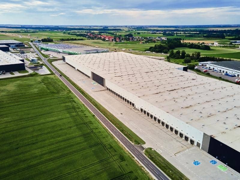
Good site data is important when building or expanding a warehouse or distribution center. Engineers need to know the height and shape of the land. They also need to understand drainage, roads, loading areas, and existing buildings.
LiDAR mapping can collect detailed information across a large site. It uses laser scanning to collect many data points from the ground and other features. This information can help engineers and planners understand the site before they start designing an expansion.
Here is how LiDAR mapping can support warehouse and distribution center growth.
Mapping Existing Site Conditions Before Warehouse Expansion
Before planning an expansion, the project team needs to understand what is already on the property, including the building setback that may affect where a new warehouse, loading area, or other improvement can fit.
LiDAR mapping can collect detailed information about the site. This may include:
- Ground elevations
- Existing buildings
- Roads and pavement
- Drainage areas
- Ponds and swales
- Trees and other vegetation
This information can be used to create a detailed model of the property. It can also help teams understand how the fence location relates to nearby roads, buildings, and other existing site features.
Large warehouse sites can take time to measure from the ground. They may have buildings, parking areas, truck courts, fences, and other features that make field work more difficult.
LiDAR can collect a large amount of site data quickly.
This gives engineers a clear starting point when planning where new buildings, roads, or other improvements may go.
Checking Grades for Truck Courts and Loading Areas
Truck courts and loading areas need careful grading.
If the ground is not graded correctly, water may collect near loading docks or other paved areas. Poor grades may also make it harder for trucks and trailers to move around the site.
LiDAR mapping provides detailed elevation data that engineers can use to study these areas.
The data can help them understand:
- Where the ground is high or low
- How water may move across pavement
- How loading areas connect to the rest of the site
- Where grading changes may be needed
LiDAR collects many elevation points across the site. This can give engineers a detailed view of the ground instead of relying only on a small number of measurements.
The information can then support grading and drainage plans for truck courts and loading areas.
Planning New Buildings Around Existing Site Limits
Adding another warehouse building is not always as simple as finding an empty part of the property.
Existing features may limit where a new building can go.
LiDAR mapping can help show the location and shape of many site features, such as:
- Existing buildings
- Retention ponds
- Drainage areas
- Roads and pavement
- Changes in ground elevation
- Other visible site features
This information helps planners understand how much space may be available for future development.
For example, a new building may need to fit between an existing truck court and a drainage pond. Changes in ground elevation may also affect where the building pad can be placed.
LiDAR data gives the design team a clearer view of these conditions before detailed plans are prepared.
Zoning, easements, and other land use rules should also be reviewed before choosing a final building location.
Supporting Drainage and Stormwater Design
Large warehouses create a lot of water runoff.
Rain falls on roofs, parking areas, roads, and truck courts. This water needs somewhere safe to go.
LiDAR mapping provides elevation data that can help engineers understand how water moves across the property.
This information can support the design of:
- Retention ponds
- Drainage areas
- Swales
- Stormwater systems
- Site grading
Detailed elevation data can show high and low areas across the site. Engineers can use this information when planning how water should move away from buildings and paved areas.
This is especially important in Florida, where flat land and heavy rain can create drainage problems.
Stormwater rules can be different depending on the location and project. The design team should check current local requirements before completing the drainage plan.
Using LiDAR Data for Phased Distribution Center Growth
Some warehouse and distribution center projects are built in several phases.
A developer may build one warehouse first and add more buildings later.
LiDAR mapping can help with this type of long-term planning.
The first LiDAR survey can create a detailed model of the site. When another phase begins, the data can be updated to show new buildings, pavement, drainage areas, and other changes.
This can help the design team understand how the next phase will connect with the existing development.
Before planning another phase, check:
- Whether the LiDAR data is still current
- How new buildings will connect with existing grades
- How drainage will work between the old and new areas
- Whether existing utilities can support the expansion
- Whether easements affect the new building area
- What permits or approvals are needed
Updating site data before each major phase helps the design team work with current conditions instead of older information.
Frequently Asked Questions
How is LiDAR mapping different from a traditional topographic survey?
LiDAR uses laser scanning to collect many elevation points across an area. A traditional topographic survey normally uses ground-based survey equipment to measure selected points. The best method depends on the site and the type of information needed.
Is LiDAR mapping accurate enough for engineering design?
LiDAR can support engineering design when the data is collected and processed to the accuracy needed for the project. The required accuracy should be discussed with the surveyor and engineer before data collection begins.
Can LiDAR mapping be used on a site with existing buildings?
Yes. LiDAR can collect information about buildings, pavement, ground elevations, and other visible site features. This makes it useful when planning an expansion on an already developed property.
Does LiDAR mapping replace a boundary survey?
No. LiDAR mapping is mainly used to collect topographic and site condition data. A boundary or ALTA survey may still be needed to establish property boundaries and show recorded easements.
How long does LiDAR mapping take for a large industrial site?
The time depends on the size and condition of the property, the type of LiDAR used, the required accuracy, and how much data must be processed. LiDAR can often collect data across large sites efficiently, but the surveyor should provide a timeline for the specific project.