
Topographic Survey Data Needed Before Building a Community Sports Complex
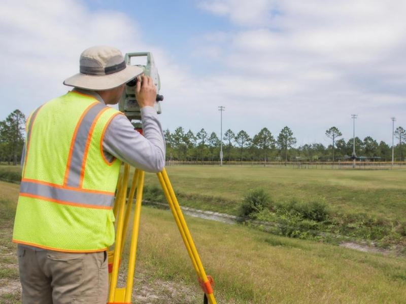
A sports complex hides a lot of risk in the ground. Fields need to drain. Courts need to sit level. Parking, walkways, and seating all have to connect in a way that works for real people. Get the ground wrong, and you pay for it later in flooding, redesigns, or failed inspections.
Good topographic survey data lowers that risk. It shows the site as it really is, not as a plan assumes it to be. In a place like Pensacola, where heavy rain and flat, low-lying land are common, that ground truth matters even more. This is the information your design team needs before anyone draws a single field.
Mapping Existing Ground Elevations Across the Site
Topographic survey data starts with elevation. A surveyor measures many points across the site and records how high or low each one sits. Those points build a picture of the land’s shape. Designers call this the existing grade.
This matters because a sports complex has to fit the land. Baseball fields, soccer fields, and courts each want a certain slope. Too flat, and water sits on the surface. Too steep, and play gets unfair or unsafe. The survey shows where the site already helps you and where it fights you.
The data also reveals things the eye misses. A field that “looks flat” can drop a foot or more across its length. On a large site, small changes add up fast. Knowing the real numbers early helps a designer place fields where they need the least grading.
Grading costs real money. Moving dirt is one of the biggest line items on a site like this. Accurate elevation data lets the team balance cut and fill, which means using the dirt you dig out to raise low spots. That balance can save a project a lot of hauling. It starts with a clear map of the ground.
Locating Drainage Features and Potential Water-Flow Paths
Water is the main enemy of any sports site. Fields turn to mud. Parking lots pond. Games get canceled. Topographic survey data helps the team see how water moves before they build.
A surveyor maps the visible drainage features on the site. That includes ditches, swales, low areas, culverts, and any spot where water collects. These points show the natural paths water wants to take. Designers use them to plan grading and stormwater systems that work with the land, not against it.
In the Pensacola area, this step carries extra weight. The region sees strong storms and heavy rain. Flat ground and a high water table make drainage harder. A site that drains fine on a dry day can flood in a downpour.
The survey gives the design team a starting point for stormwater planning. They can see where runoff enters the site and where it needs to leave. From there, they plan ponds, pipes, and grading that keep fields playable. Stormwater rules can vary by city, county, and project scope, so confirm local requirements early. The survey data makes those conversations far easier.
Documenting Utilities, Easements, and Existing Improvements
A site is rarely empty. It usually holds utilities, access routes, and structures that shape what you can build. Topographic survey data records these features so the team knows the site’s limits.
The surveyor maps the things that are visible or marked on site. That often includes:
- Utility markings for water, sewer, power, and gas lines
- Existing driveways, roads, and access points
- Buildings, sheds, fences, and other structures
- Poles, signs, and drainage structures
Easements are just as important. An easement is a legal right for someone else to use part of your land, often for utilities or access. A drainage or utility easement may run right through the best spot for a field. If you build over it, you may face costly conflicts later.
Knowing these constraints early changes the design. A team can route parking around a power line or shift a building off an easement. Fixing that on paper is cheap. Fixing it after construction is not. This is why the survey happens before design, not after.
Supporting Accessible Routes and Facility Connections
A sports complex is many small spaces that must connect. People park, then walk to fields. They move between courts, restrooms, and seating. Those paths have to be safe and easy to use for everyone.
Accurate elevation data makes this possible. Designers use it to check slopes on walkways, ramps, and parking areas. Accessible routes have to stay within certain grades so that people using wheelchairs or strollers can move without trouble. The survey shows whether the land supports those routes as they are or needs grading first.
The same data guides entrances and seating. A gentle slope near an entrance can become a drainage problem or a trip hazard if no one checks it. Seating areas need level ground for safety and comfort. Topographic survey data lets the team test these ideas before they commit.
Good connections also improve how the whole site feels. Smooth transitions between parking, walkways, and fields keep crowds moving on busy game days. That planning depends on knowing the real elevations across every part of the complex.
Establishing Survey Control for Design and Construction
Every measurement on a project needs a shared reference. That reference comes from survey control. These are fixed points with known horizontal and vertical positions across the site.
Think of control points as anchors. Horizontal control tells you where things sit on a map. Vertical control tells you how high they sit. Every field, building, and pipe gets tied back to these same points. That keeps the whole project consistent.
Control matters most when work moves from paper to dirt. During construction, crews use these points to stake out fields, foundations, and utilities in the right spots. This is called construction layout or staking. Without solid control, small errors creep in and grow.
Control also supports later checks. As the project develops, a surveyor can return to the same points to verify that work matches the plan. That is often done with as-built surveys, which record what was actually built. Consistent control makes each of these steps line up. It ties design, construction, and verification into one system.
Frequently Asked Questions
What is topographic survey data?
Topographic survey data is a detailed record of a site’s shape and features. It shows ground elevations, slopes, drainage points, utilities, and existing improvements. Designers and engineers use it to plan a project that fits the real land. For a sports complex, it guides field placement, grading, drainage, and access.
When should we order a topographic survey for a sports complex?
Order it before design begins. The design team needs the ground data to place fields, plan drainage, and set grades. Ordering late can force redesigns and delay permits. If timing, permitting, or construction depends on the survey, confirm the schedule early with your surveyor.
Does a topographic survey show underground utilities?
It shows what is visible or marked on the surface, such as utility flags, meters, and manholes. It does not X-ray the ground. For a full picture of buried lines, a project may need utility locating or subsurface utility engineering. Ask your surveyor what level of detail your project scope requires.