
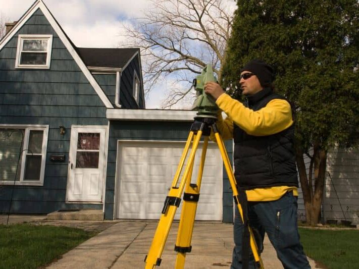
How Long Does a Land Survey Take?
If you’re planning a project, you’ve probably asked this already: how long does a land survey take?
You might be buying land, building a fence, or getting ready to start construction. Everything feels ready to move forward, but then the survey becomes the one thing holding it up. That wait can feel frustrating, especially when other steps depend on it.
The timeline is not always the same. Some land survey jobs move quickly, while others take longer than expected. It all depends on the property and what the surveyor finds along the way.
Here’s what you can expect and why delays happen more often than people think.
What Is the Typical Timeline for a Land Survey
Most residential land survey projects take about three to seven days. That applies to smaller properties with clear records and easy access.
However, larger or more complex properties often take one to three weeks. In some cases, it can go even longer if problems show up during the process.
Many people assume a land survey only involves measuring the property. In reality, it includes research, field work, and final mapping. Each step takes time, and each one can affect how quickly the survey is completed.
Why a Land Survey Takes More Than One Visit
A land survey does not happen in a single step. It starts before the surveyor even arrives at your property.
First, the surveyor reviews property records such as deeds and past surveys. These documents help confirm legal boundaries. If everything is clear, this part moves quickly. If not, more time is needed to sort things out.
After that, the surveyor visits the property. They measure the land, locate boundary markers, and sometimes set new ones. This part depends heavily on the condition of the land.
Once field work is complete, the data goes back to the office. The surveyor creates a detailed drawing that shows property lines and important features. Before releasing it, they double-check everything for accuracy.
Each of these steps matters. Skipping or rushing any part can lead to mistakes.
What Usually Delays a Land Survey
Delays often come from things outside your control, but they are also very common.
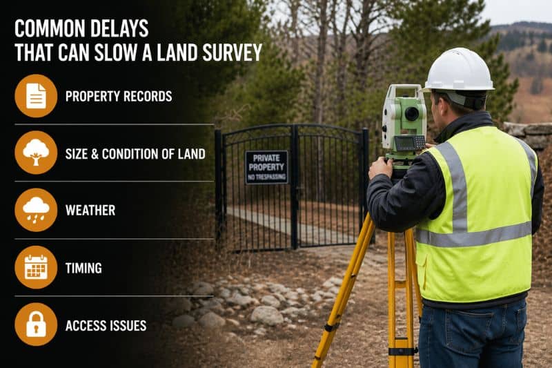
Property records can cause problems right away. Some older properties have unclear or conflicting descriptions. When that happens, the surveyor needs more time to verify the correct boundaries.
The size and condition of the land also play a big role. A small, open lot is easier to measure. On the other hand, large properties or areas with trees and uneven ground slow the process down. Survey crews need more time to move around and take accurate measurements.
Weather adds another layer of delay. Rain can make the ground difficult to work on, and some areas may become hard to reach. Because of this, surveyors may need to wait for better conditions before finishing the job.
Timing matters too. During busy seasons, especially spring and summer, more people are building or buying property. That means surveyors have full schedules. If you book late, you may have to wait your turn.
Access issues also come up more often than expected. Locked gates, fences, or blocked entry points can prevent surveyors from reaching certain parts of the property. Even small obstacles can slow everything down.
How You Can Help Speed Up the Process
While you can’t control every delay, you can make things easier from the start.
Having your documents ready makes a big difference. If you can provide your deed or any previous land survey, the research step becomes faster.
Making sure the property is easy to access also helps. Clearing entry points or unlocking gates allows the survey crew to work without interruption.
Scheduling early is one of the best moves you can make. When you plan ahead, you avoid peak season delays and give yourself more flexibility.
Working with a local surveyor also helps. They are familiar with the area, local records, and common issues, which can speed things up.
Why Timing Your Land Survey Matters
A land survey is often one of the first steps in any project. Because of that, delays can affect everything that comes after.
Construction may get pushed back. Permit approvals can take longer. Closing dates for property purchases might shift.
These delays can lead to extra costs and unnecessary stress. That’s why it’s better to plan ahead instead of rushing at the last minute.
Getting Your Land Survey Started
If you’re planning to build, buy, or make changes to your property, it’s smart to schedule your land survey early.
The sooner you get it done, the easier it is to stay on track. You avoid delays, reduce surprises, and move forward with confidence.
A clear and accurate land survey gives you a strong starting point. From there, everything else becomes much easier to manage.