
Flood Survey Timing Before Insurance, Permits, or Renovation Work
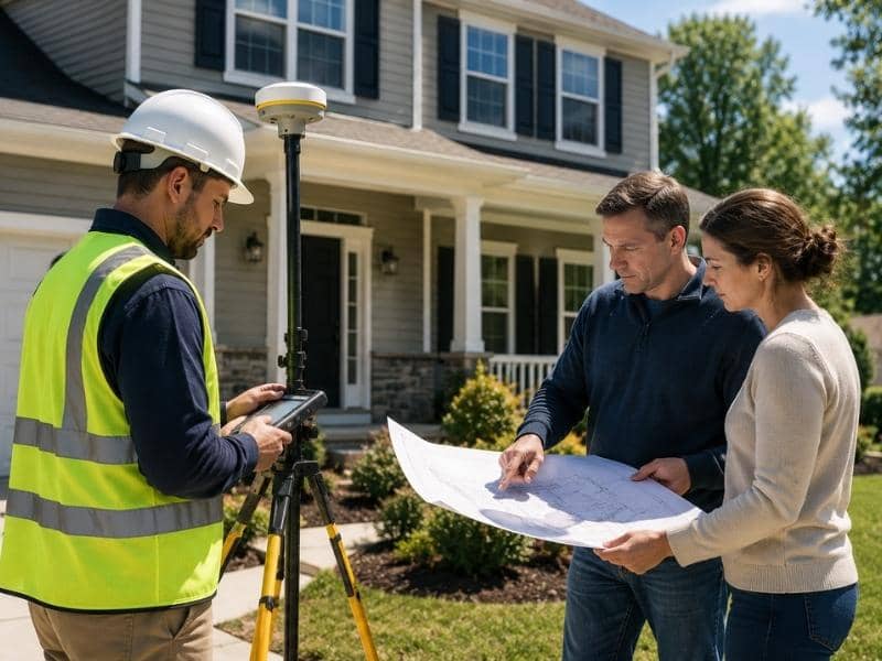
A flood survey measures how high a property and its buildings sit compared to FEMA’s base flood elevation. That number affects insurance costs, permit approvals, and what rules apply to a property in a flood zone. For properties in Zone AE or Zone VE, getting a flood survey at the right time avoids delays and unexpected costs. Schedule it too late and deals fall apart, permits get held up, and construction stops.
Timing matters more than most property owners think.
Why Getting a Flood Survey Early Saves Time and Money
Property owners should get a flood survey before making any big property decision. An early survey gives verified elevation data that affects insurance costs, permit requirements, and flood rules, so owners have the facts before anything gets decided.
If a property sits in a Special Flood Hazard Area, that changes costs and rules in a big way. Flood insurance may be required. Building rules may apply. Floor heights may need to meet set standards before a permit gets approved.
When you know this before signing a contract or pulling a permit, you have time to prepare. You can check the cost of meeting flood rules and ask the right questions early. When you find out in the middle of a project, your choices are limited.
What a Flood Survey Tells You Before Buying Insurance
A flood survey gives insurance agents the elevation data they need to set an accurate flood insurance rate. Getting a survey before buying or updating coverage can stop overpayment and make sure the policy matches what the property actually looks like.
Under FEMA’s Risk Rating 2.0 system, which took full effect for all NFIP policies on April 1, 2023, insurance rates now reflect a property’s actual flood risk, not just its flood zone label. A building one foot below the base flood elevation pays much more than one built two feet above it. Across the country, NFIP premiums average around $700 to $800 per year. But properties in high-risk AE and VE zones without current elevation data can pay two to four times that amount.
Without a current survey, agents may use rough estimates that push premiums higher than the property’s real elevation calls for.
How a Flood Survey Keeps Permit Applications Moving
Some building projects near a flood zone need elevation data before a local building department will approve a permit. New construction in a Special Flood Hazard Area almost always needs this. So do additions that make a building bigger, detached structures near drainage areas, and buildings in coastal flood zones.
When a permit application comes in without the required elevation data, the review stops. The department sends a notice, the applicant has to order a survey, and the project waits. Having a current flood survey ready when you apply means the reviewer has what they need right away, and the project keeps moving.
What Flood Rules Mean for Renovation Projects
Flood rules apply to existing buildings, not just new ones. Under FEMA’s National Flood Insurance Program guidelines (44 CFR Part 60), if a renovation costs 50 percent or more of the building’s value before the work starts, the whole building must meet current flood elevation standards. That can mean raising the structure to meet the current base flood elevation, which can change the cost and scope of a renovation by a lot.
A flood survey before a renovation gives contractors and homeowners accurate elevation data to work with. It also shows whether a project might cross that 50 percent line before money gets spent on plans or materials.
When an Existing Flood Survey Is No Longer Reliable
A flood survey does not stay useful forever. FEMA updates Flood Insurance Rate Maps on a regular basis. When a map update affects a property, an older certificate may no longer match the current base flood elevation. That means it may not work for insurance or permit purposes.
Big site changes like grading, fill work, or drainage work can also create a gap between what an old survey shows and what the property looks like now. Property owners who are not sure if their certificate is current should check the date on it against the date of the most recent FIRM map update for their area.
Frequently Asked Questions
When should I get a flood survey before a renovation project?
Get a flood survey before setting your renovation budget or sending in a permit application. If the total project cost gets close to 50 percent of the building’s current value, flood compliance rules may apply under FEMA’s substantial improvement rule (44 CFR Part 60). Knowing your elevation data before talking to the building department keeps things on track.
Can a flood survey help with building permits?
Yes. For projects in or near a Special Flood Hazard Area, local building departments usually need current elevation data before approving a permit. Sending in a flood survey with your application from the start keeps the review from stopping due to missing paperwork.
Should I get a flood survey before buying flood insurance?
Yes. Under FEMA’s Risk Rating 2.0 system, flood insurance rates reflect a property’s actual flood risk, including how high the building sits compared to the base flood elevation. A current flood survey gives your agent accurate data, which can stop you from paying more than you should.
Do I need a new flood survey if flood maps change?
Yes. A map update can change the base flood elevation for an area. An older certificate based on an outdated map may not meet current standards for insurance or permit review. An updated survey tied to the current FIRM map keeps your records accurate for both.
What types of projects may need a flood survey?
Home additions that make a building bigger, detached structures near drainage areas, new construction in a Special Flood Hazard Area, and large renovations that may cross the 50 percent threshold are the most common projects that need current flood survey data before permits can move forward.