
Boundary Survey Problems That Can Stop a Fence Project Midway
You’ve got materials ordered, permits in hand, and a crew ready to go. Then the boundary survey comes back with problems. Just like that, the whole project stops.
Boundary survey problems are one of the most common reasons fence projects get delayed. For developers, that means extra costs, unhappy clients, and schedules that fall apart fast. Knowing what these problems look like before you break ground can save a lot of trouble.
Unclear Property Lines Can Lead to Costly Delays
Before any fence goes in the ground, the property line has to be clear. Not roughly clear. Exactly clear.
When boundary lines are wrong or disputed, the project stops until the problem gets fixed. That can take days. Sometimes it takes weeks. If lawyers get involved, it takes even longer.
Property lines get unclear for a few reasons. Old deeds use vague language. Past surveys used different starting points. Two neighboring lots were measured at different times and the numbers don’t match. Any of these can block fence placement.
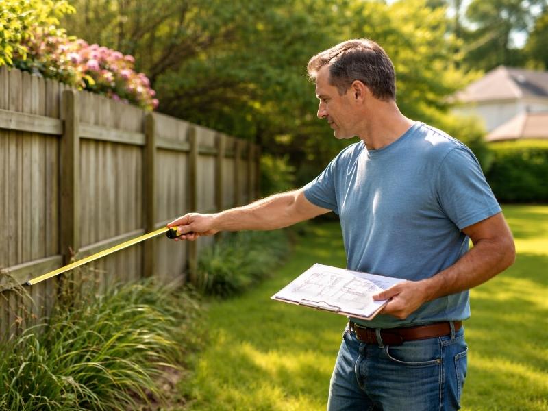
A boundary survey done before construction is the only reliable way to know where the line is. Skipping it to save time almost always wastes more time later. A licensed surveyor checks deed records, plat maps, and physical markers on the ground. That gives you a solid, accurate line to build from.
Missing or Damaged Property Markers Create Uncertainty
Property corners are marked with physical monuments. These are usually iron pins, concrete posts, or brass caps placed by a surveyor. They show exactly where the property corners are.
The problem is they don’t always stay put.
Grading equipment knocks them loose. Construction crews bury them by accident. Soil shifts over time and covers them up. When those markers are gone, the fence location becomes a guess. Guessing on a fence line is expensive.
When monuments are missing, a surveyor has to find the boundary another way. That means going back to original plat records, measuring from nearby reference points, and sometimes working with surveys from nearby properties. It’s possible to do, but it takes more time and costs more money.
Before layout work starts, make sure all corner markers are there. If any are missing, get a surveyor to find or replace them before the fence crew shows up. Discovering this problem mid-project makes everything twice as hard.
Neighboring Property Disputes Can Interrupt Fence Installation
A fence sits right on the edge between two properties. That makes it easy for disputes to start.
Neighbors often have a different idea of where the line is. Maybe they’ve been cutting the grass on a strip of land for years and think it’s theirs. Maybe an old fence was put in the wrong place and no one questioned it. Maybe they just don’t agree with the survey.
Any of these can shut a fence project down fast. A neighbor can file a complaint with code enforcement. They can request a stop-work order. In some cases, they take legal action. None of that is good for a project schedule.
A certified land survey gives you clear, documented proof of where the boundary is. That proof changes the conversation. It shifts things from opinion to fact.
It also helps to get your neighbor’s sign-off in writing before the fence goes up. A short conversation now prevents a much bigger problem later.
Easements and Right-of-Way Restrictions May Affect Fence Placement
Finding the property line is just the first step. You also need to know what you’re allowed to build along it.
Easements give other parties the legal right to use part of your property. Utility easements are the most common type. They usually run along property edges, which is right where most fences go. Drainage easements and public rights-of-way create the same issue.
Building a fence inside an easement isn’t always banned, but the easement holder can remove any structure that gets in their way. That means your fence could come down with no payment owed to you. That’s a big risk for any developer.
A boundary survey shows recorded easements. But some easements only exist in utility company files and won’t show up in public records. A boundary survey combined with a title search gives you the full picture.
If an easement runs along your planned fence line, change the layout before you build. Changing a plan on paper costs nothing. Tearing out a finished fence and rebuilding it costs a lot.
Outdated Surveys and Local Regulations Can Cause Unexpected Setbacks
An old survey is not always a good survey. Property conditions change over time. Roads get rerouted. Lots get split up. Drainage work shifts legal boundaries. A survey done 20 years ago may not show any of that.
Using old survey data for a current project is risky. The line on an old plat might not match what a new survey would show today. Building from outdated data can put the fence in the wrong spot.
Local rules add another layer of concern. Most cities and counties have fence rules that cover height limits, allowed materials, and how far a fence must sit from the property line. Some zoning areas restrict certain fence types. Many places require a permit before any fence work begins.
Breaking these rules has real consequences. A fence built outside of local code can lead to a stop-work order, a forced tear-down, or a fine. Any of those adds cost and time to the project.
The solution is simple. Get a current survey. Check local fence rules before the design is final. Confirm permit requirements early. A little time spent upfront prevents much bigger problems during construction.
Frequently Asked Questions
What boundary survey problems most often stop fence projects?
The most common issues are unclear property lines, missing survey markers, neighbor disputes, easements along the fence line, and outdated survey data. Any one of these can stop construction until it’s resolved.
Can a fence be built inside a utility easement?
It depends on the easement terms. If the easement holder needs full access, they can require the fence to be removed. Always check the easement language and confirm with the utility provider before building in that area.
What happens if survey monuments are missing before fence installation?
A licensed surveyor has to rebuild the boundary line using deed records and nearby reference points. This takes extra time and adds cost. Missing monuments should be found or replaced before the fence crew starts work.
Do I need a new survey if one was already done on the property?
If the survey is recent and nothing has changed, it may still be usable. But if the lot was split, roads changed, or a lot of time has passed, a new survey is the safer choice.
How do local fence rules affect a development project?
Local rules set limits on fence height, materials, and how close a fence can sit to the property line. Some areas require permits too. Checking these rules before finalizing the design helps avoid costly changes or forced removals after the fence is built.