
Flood Survey and Elevation Certificate Timing Before Hurricane Season
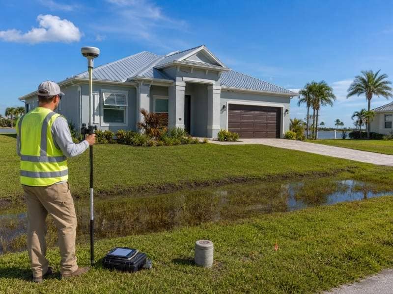
Hurricane season brings uncertainty. Getting a flood survey and elevation certificate early takes the pressure off when storms approach. Waiting until the last minute means dealing with delays, weather problems, and scheduling conflicts. Planning ahead protects your property and keeps insurance costs under control.
Why It Helps to Plan Before Storm Season
Planning early means scheduling when surveyors have availability. As storm season approaches, every surveyor books up. A July appointment might be available. An October appointment might be impossible.
Early planning also gives you time to handle results. If the survey shows flood risk, you have months to adjust insurance, make repairs, or plan improvements. If you wait until November, you’re stuck making fast decisions under stress.
Weather also matters. Wet ground, heavy rain, and storms prevent survey work. Surveyors can’t take accurate measurements during bad weather. Getting the survey done before peak season gives you the best chance of timely completion.
Flood Height Details Insurance May Need
A flood survey measures the height of your home’s finished floor and the ground level around it. These heights matter for flood insurance rates. If your floor is higher than the base flood elevation, insurance companies charge less. If it’s lower, they charge more.
An elevation certificate is the official document that shows these heights. Insurance companies need this certificate to set your premium rate. Some lenders require it before approving a mortgage. The survey provides the data. The elevation certificate documents it officially.
Getting the survey early means you have the certificate ready when you need it. If you’re selling a home, the buyer’s lender might require it. If you’re renewing insurance, your agent might ask for one. Having it done ahead of time prevents delays at closing or in insurance renewals.
Weather Delays That Can Slow the Survey
Heavy rain makes survey work impossible. Flooded areas prevent field access. Surveyors can’t measure ground elevation when water covers the land. Storm winds make equipment unsafe to use. Lightning forces crews off site.
Scheduling flexibility matters more in storm season. A surveyor booked for three weeks out might need to reschedule if a storm passes through. A surveyor booked months in advance has time to work around weather delays. Getting scheduled early gives your project more flexibility if bad weather forces a reschedule.
Wet ground also affects work. Even after rain stops, the ground stays soft and muddy. Heavy equipment sinks. Measurements become less accurate. Time must pass before the ground dries enough for safe work.
Getting your survey done in early summer or spring avoids these weather challenges entirely. The ground is dry. Storms are less frequent. Surveyors have more availability. The work gets done faster and with better accuracy.
Survey Results That Help With Flood Planning
A flood survey shows you whether your property is at risk. It compares your home’s height to the base flood elevation that FEMA sets for your area. If your floor is above that level, your flood risk is lower. If it’s below, your risk is higher.
Understanding this risk helps you make decisions. If your floor is low, you might upgrade your foundation, install sump pumps, or improve drainage around the home. You might choose flood vents or waterproofing. These improvements take time and planning. Knowing your flood elevation early gives you months to plan improvements instead of scrambling in October.
The survey also identifies exactly where water would collect during flooding. Low spots on your property or in the yard become obvious. You can plan drainage improvements or landscaping changes to direct water away from your building.
Timing for Insurance, Closings, and Permits
Insurance renewal dates create deadlines. If your policy renews in December, your insurance company might want an elevation certificate by November. Getting the survey done in August gives you time to deliver it when needed.
Home sales create tight timelines. A buyer’s lender requires an elevation certificate before closing. If you’re selling, you might need the certificate within 30 days. A months-ahead survey means no delays at closing.
Permits and approvals also have schedules. If you’re planning flood improvements, an elevation certificate is often part of the permit application. Having it ready accelerates approval. Getting the survey done early keeps your project on schedule and avoids cost overruns.
Frequently Asked Questions
What is a flood survey?
A flood survey measures the height of your home and the surrounding land. It compares these heights to the base flood elevation in your area. The surveyor documents the results in an elevation certificate that insurance companies and lenders use.
Is a flood survey the same as an elevation certificate?
No. A flood survey is the field work and measurement. An elevation certificate is the official document that records those measurements. The survey produces the data. The certificate documents it for insurance and legal purposes.
When should I get a flood survey before hurricane season?
Get one early in the year, before the peak storm months. This gives you time to review results, make any improvements, and have your elevation certificate ready for insurance renewals or property sales. Scheduling in spring or early summer ensures availability and avoids weather delays.
How long does a flood survey take?
Most surveys take one to three days of field work. The surveyor needs clear access to your property and clear weather. After field work, the elevation certificate takes another week or two to prepare and deliver.
What should I do with my elevation certificate?
Keep a copy for your records. Give copies to your insurance agent, lender, and any contractor doing flood-related work. Update your insurance agent if you make improvements that change your home’s flood elevation.