
Topo Survey Findings That Can Change a Site Design Budget
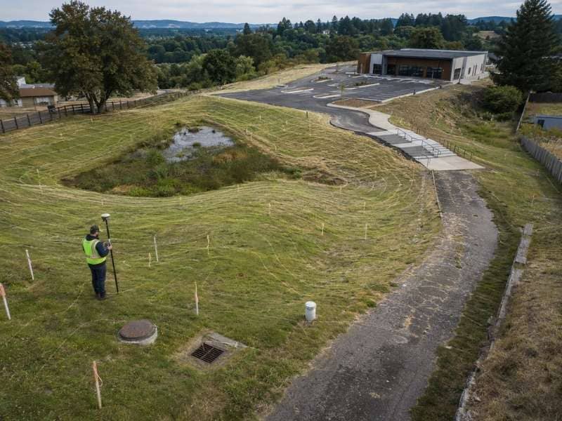
A topo survey reveals what the land actually looks like. Before design work starts, you think you know the project cost. Then the topo survey arrives, and those numbers shift. Slopes surprise you. Drainage problems emerge. Existing features block planned locations. A topo survey uncovers these issues early, when changes save money instead of costing it.
Slopes That May Need More Dirt Work
A topo survey maps slopes across the site. Some properties have gentle slopes. Others have steep elevation changes requiring serious grading. When the design team sees actual slope data, they realize the project needs more earthwork than budgeted.
Moving earth costs money. Trucks, equipment, labor, and disposal add up fast. A site that looks flat might have a 15-degree slope across two acres. The design team might terrace instead of grading flat. Either way, the topo survey data drives the cost decision.
Drainage Problems That May Need Fixing
Water flows toward low spots. A topo survey uses contour lines to show where water naturally collects and how it flows across the property. If water pools in the parking lot, you’ll need to fix it. If water flows across the building entrance, the design changes.
Drainage solutions cost money. Swales, retention ponds, and storm systems carry price tags. A site that looks well-drained might have seasonal pooling. The topo survey reveals this before construction.
Some sites need expensive drainage systems not budgeted. Others have good natural drainage that saves money. The topo survey lets you make informed decisions upfront.
Trees, Fences, and Other Site Features
Existing trees, fences, driveways, and walls are already on the property. You can remove them, but that costs money. Or you can build around them, which costs money differently. A topo survey shows all features with precise locations.
Sometimes a mature tree sits where the designer wanted a building. Remove the tree and spend $500 to $5,000. Redesign around it and avoid that cost but lose usable space. The design team needs this data to choose early.
Fences, old driveways, and utility structures complicate design. Moving around them adds distance to the road or parking lot layout. Adding distance costs more. Removing structures costs upfront. The topo survey shows obstacles so the team can plan accordingly.
Utility Features That Can Change the Plan
Visible utilities like manholes, cleanouts, and drains appear on topo surveys. Moving around them changes the road or parking layout. Going directly over them might not be possible. The design team plans accordingly when utilities are shown.
But some utilities aren’t visible. Underground lines only show up if marked. When utilities weren’t marked, contractors discovered them during excavation. Then the design changes mid-project and costs skyrocket.
A topo survey including marked utilities prevents surprises. The design team routes parking lots and utilities with full knowledge of what’s underground. This avoids utility conflicts and saves money.
Height Changes That Affect Access
Sidewalks, ramps, and entrances need accessibility compliance. Height changes create challenges. Designs that work on flat land need rethinking on slopes.
A topo survey shows exactly how much elevation exists between building entrance and street. A three-foot difference needs a ramp. A six-foot difference needs a longer ramp or steps. The topo survey data helps the design team understand constraints and budget accordingly.
Sites with significant elevation changes need retaining walls, extended ramps, or terraces to meet code. A design that didn’t account for slopes ends up with expensive fixes. The topo survey prevents this by showing constraints upfront.
Frequently Asked Questions
What does a topo survey show?
A topo survey shows land height, slopes, existing site features like trees and fences, visible utilities, and drainage patterns. It maps all details with precise elevation data to create a complete picture of the site.
How can a topo survey change a budget?
The survey reveals conditions affecting design cost. Steep slopes need more earthwork. Drainage problems need solutions. Trees and utilities force design changes. Height differences require accessibility features. Each discovery might change project cost.
When should I get a topo survey?
Get one before final site plans and cost estimates. Waiting until after permits wastes money. Early surveys let designers make informed choices about grading, drainage, and building placement that fit the budget.
Can a topo survey reduce project costs?
Yes. The survey might reveal good natural drainage, eliminating expensive systems. Or slopes working in your favor, reducing grading needs. Good existing features sometimes reduce what design needs to add.
What happens if you skip the topo survey?
You discover site conditions during construction. That’s when changes are most expensive. Unexpected drainage problems, utility conflicts, and slope issues force redesigns mid-project. Costs climb. A topo survey upfront prevents these surprises.