
LiDAR Mapping for Wetland Edges, Low Ground, and Overgrown Parcels
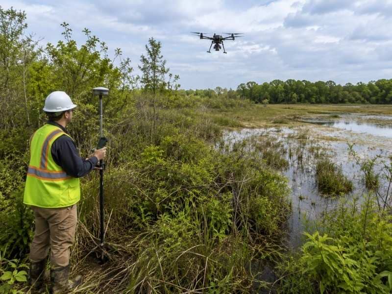
LiDAR mapping uses laser pulses to measure the ground and build detailed maps of a property. It collects millions of data points fast, giving surveyors a clear picture of how the land sits. For land near wetland edges, low or wet ground, and parcels covered in thick brush, LiDAR mapping gets information that would be very hard to collect any other way. These are the kinds of sites where normal survey methods slow down, and where missing ground details cause real problems later.
Mapping Wetland Edges with LiDAR for Clearer Land Details
Wetland edges are some of the hardest areas to read from the ground. The land shifts from dry to wet in ways that are not always easy to see, and knowing exactly where that shift happens matters a lot. LiDAR mapping picks up those changes across the full area in fine detail. It shows where the ground drops, where water sits, and how one type of land condition turns into another.
That detail matters when questions come up about how a parcel near a wetland can be used. Accurate elevation data shows where firm, dry ground ends and where wetter ground begins. Without that information, decisions about how to use the land are based on rough estimates instead of real measurements.
How LiDAR Mapping Helps Survey Low and Wet Areas
Low ground and wet areas create big problems for survey crews working on foot. Soft soil makes it hard to move equipment safely. Standing water and thick ground cover slow things down. In some spots, getting a crew into certain parts of a parcel is just not possible. Since LiDAR mapping collects data from above, those access problems do not stop the survey from getting done.
The elevation data from low areas is also more complete than what ground crews can collect by hand. LiDAR records thousands of measurements every second across the full surface, so it picks up small changes in ground height that other methods might miss. On low parcels where even a few inches of grade change affects how water drains, that level of detail gives surveyors a much clearer picture of how the land works.
Seeing Through Thick Brush on Overgrown Parcels
Overgrown parcels covered in tall grass, thick brush, or dense shrubs are different from wooded land. Low brush sits right at or near the ground, so it can block or scatter laser returns. Surveyors who work with LiDAR data on these sites filter the returns during processing. They separate hits that reached the ground from returns that bounced off plants before getting there.
The result is a ground model that shows the actual surface under the brush, not just the top of the plant cover. For parcels that have not been cleared in years, this gives surveyors and property owners their first real look at what the ground looks like. That information is useful before any clearing work starts, since it shows the shape of the land under the overgrowth without anyone having to push through it first.
Using LiDAR Mapping to Support Wetland Redevelopment Plans
When property owners and planners look at sites near wetlands, they need solid data before they can make good choices about what is possible on a parcel. LiDAR mapping gives them a detailed elevation model that shows how the land sits next to water features, drainage paths, and low areas. That kind of information is hard to get from aerial photos or a regular site visit.
For redevelopment planning near wetlands, LiDAR elevation data helps show which parts of a site sit at usable grades, where fill or drainage work may be needed, and how water moves across the land when conditions get wet. Planners and builders use this to understand what a site can support before money gets spent on plans.
How LiDAR Data Gets Checked Against Field Measurements
LiDAR mapping produces a lot of elevation data fast, but that data does not stand on its own. Surveyors check it by comparing it to physical measurements taken at known points on the ground. These check points confirm that the LiDAR data matches real conditions within the accuracy levels the project needs.
On wetland and low-ground parcels, this step is especially important. Ground conditions in these areas can vary in ways that affect how laser returns get sorted during processing. Comparing the processed data to field measurements at key spots helps find any areas that need to be adjusted. The result is a final map that is both detailed and confirmed, which is what engineering and permitting work requires.
Frequently Asked Questions
What is LiDAR mapping?
LiDAR mapping uses laser pulses to measure the distance between a sensor and the ground. The system fires thousands of pulses every second and records how long each one takes to bounce back. That data gets turned into a detailed elevation map of the property.
Can LiDAR mapping help near wetland edges?
Yes. LiDAR mapping picks up small changes in ground elevation near wetland edges. It shows where the land drops and where water tends to collect, giving surveyors and planners a clear picture of where dry and wet ground meet on a parcel.
Does LiDAR mapping work on overgrown land?
Yes. LiDAR mapping collects data from above the surface, so thick brush and tall grass do not stop it. The data gets filtered during processing to separate ground hits from plant returns, which shows the real shape of the ground underneath.
Why is LiDAR mapping useful for low ground?
Low and wet areas are often hard or unsafe to reach on foot, and small grade changes affect how water drains across the land. LiDAR mapping collects detailed elevation data across the full surface without needing direct ground access, giving surveyors a complete picture of low areas on a parcel.
How do land surveyors use LiDAR mapping?
Surveyors use LiDAR data along with field measurements taken at known ground points. The field measurements confirm the accuracy of the LiDAR data, and together they produce a detailed, verified elevation map that meets the standards needed for engineering, permitting, and land planning work.